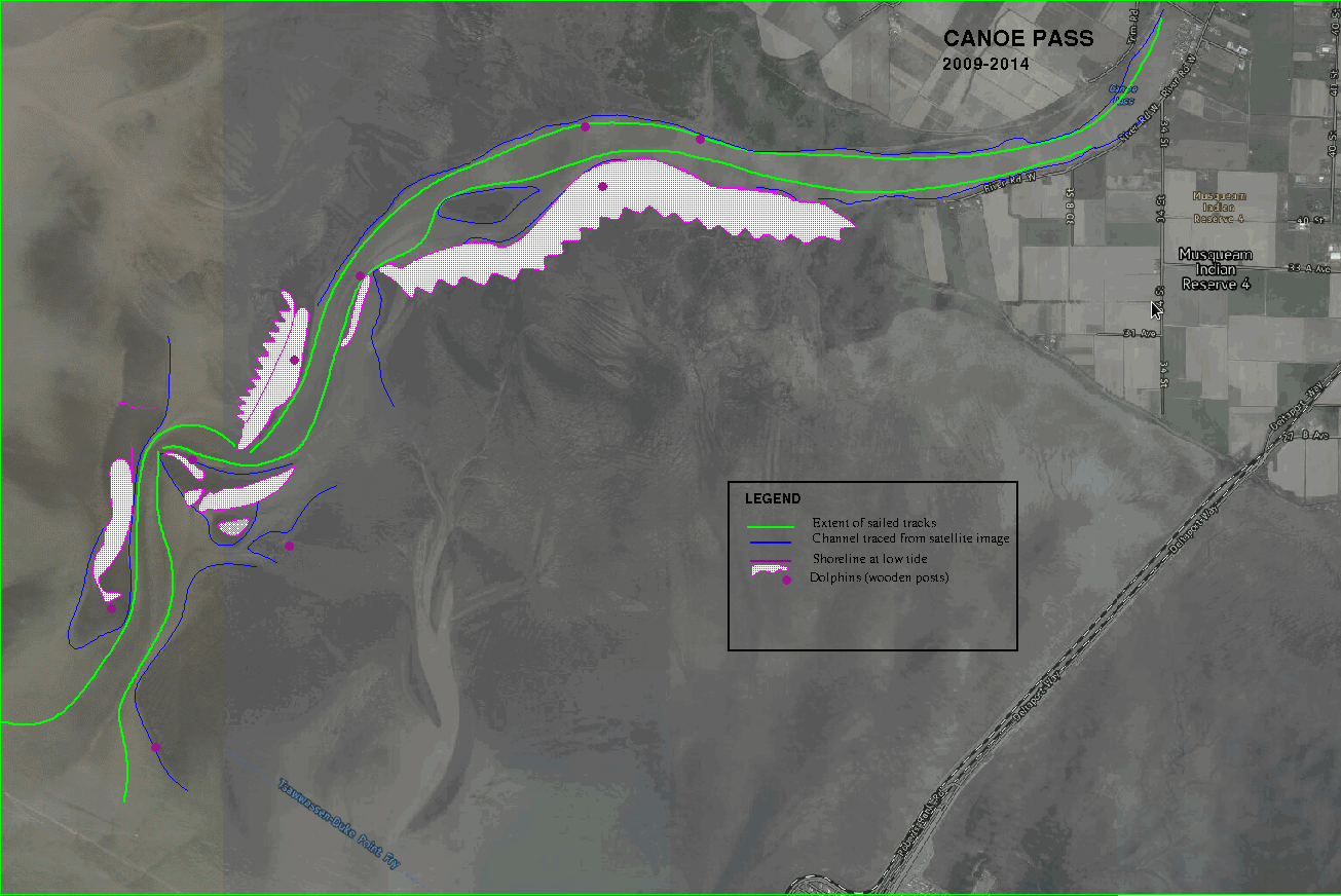
Canoe Pass Soundings and chart
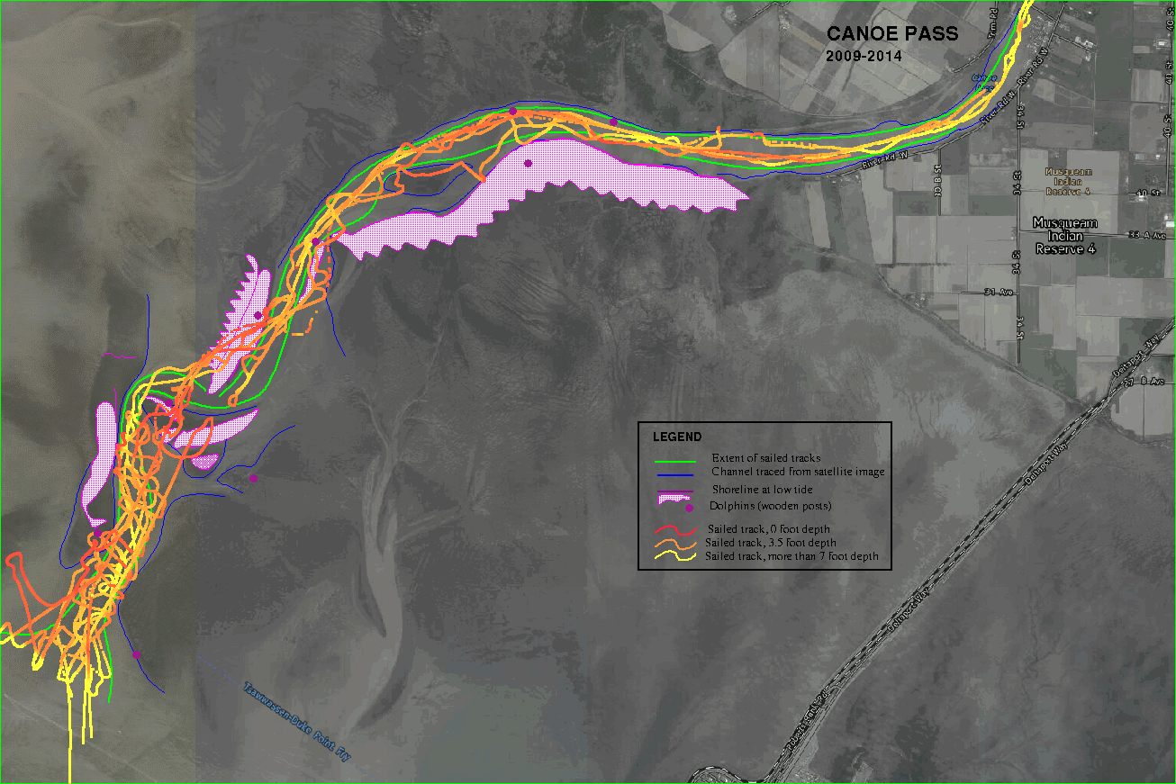
Canoe Pass is a channel south of the major South Arm of the Fraser River in Vancouver, at location approximately 49.064, -123.207.The channel is navigable at high tide "with local knowledge". Typically the official charts are out-of-date as the sandbanks move around. The images below show the location of some of the shoreline (in purple) in June 2014. The lower image shows some sailed tracks recorded between 2010 and 2013, with depths reduced to datum using published tide tables for "Canoe Pass". Virtually all the channel is still covered at a 2.0 metre low tide, so that a vessel drawing less than one metre may safely traverse the channel at high tide (3.5m) without undue risk of grounding. Vessels drawing two metres may traverse the channel on a rising tide with some care.
The background image is from here.com (Nokia). Note that the sandbars at the seaward end of the channel have moved since these satellite photographs were taken. At the time of writing (June 2014), the satellite images used by Google Maps were even more out of date. Some of the images used by Bing are the same as here.com, i.e. also outdated.